To get some perspective, one must first climb to a high place.
There are many routes to the top of Pale Heights. Earlier this year I approached it from Mouldsworth, passing Eddisbury Lodge and Nettleford Wood. At other times I have climbed it from Gresty’s Waste, Yeld Lane, The Delamere Forest Visitor’s Centre and Barns Bridge Gates. I think that the most testing route however is the one that takes the service road leading up from Delamere Station to the communication masts. This route makes little consideration for the hill’s contours and uses the most direct route to the top passing Old Pale Farm on its relentless climb.
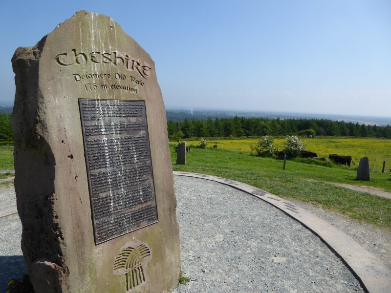
Close to Kelsall, this seemingly unremarkable hill can be identified by the three telecommunication masts that stand on its summit. At 577 feet, the hill looks over the Cheshire plain and provides spectacular views to the north, east and west. It’s central position in the county means that the hill rewards both walker and cyclist with probably the finest panoramic views that they will find of Cheshire.
I’m not a big fan of uphill cycling, but Pale Heights is a favourite that I consider worth the effort. I cycle up here at least once each year; it’s a climb that tests my stamina and fitness. Eighteen months ago I bought a new bike and the first thing I did, to put it to the test, was cycle up this hill.
Pale Heights is modest hill, particularly when compared with Moel Famau at 1,820 feet, the highest point in the Clwydian hills, and the most notable feature on the western skyline. To the north-east you can see Manchester Airport and over in a south-easterly direction is Jodrell Bank. In midsummer the sun can be seen setting into Liverpool Bay. This is one of the few places from which you can see both Liverpool and Manchester.
To the east there are views towards the Peak District, including Shining Tor on the Derbyshire border, whose 1,834 foot summit is the highest point in the county and three times higher than Pale Heights. Beyond can be seen Kinder Scout, Derbyshire’s highest point.
Much nearer, beyond the farm and situated on the hill’s south-east shoulder, stands Eddisbury Hill fort, an Iron Age earthwork that gives the local parliamentary constituency its name. That area is also called Old Pale. The term Pale is used to describe an area of enclosure land; possibly in this case it was used to protect deer or livestock from poaching and theft.
Delamere forest, which surrounds Pale Heights today, represents the last remnants of the ancient hunting forest of Mara once belonging to Edward, The Black Prince. Amongst the prince’s titles was, Earl of Chester. Edward was son to Edward III and father to Richard II. He was a Prince however destined never to become a King.
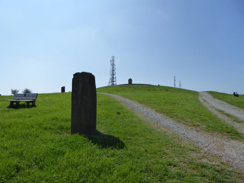
Today, Pale Heights is marked by a modern-day stone circle, each stone originating and representing one of the seven counties that can be seen from this point. The central stone represents Cheshire and is made from the local Sandstone. This stone is encircled by a set of small metal plaques identifying the many landmarks that can be seen from this vantage point.
From Chester, Pale Heights is a great bike ride and can be cycled in a little over an hour each way. It’s a good place to go with other people but it’s also a great setting if you want to be alone. As in biblical times, high places can still be good locations to talk with God. Regardless of your faith however, Pale Heights is always a good place to fill your lungs with fresh air and get some perspective.