Category Archives: History

The Mariners’ Beacon (BCQ 332)

The Mariners’ Beacon, Grange, Wirral, Merseyside.
Burton Point

I’ve not added to my list of British Cycle Quest checkpoints for some time. On BCQ rankings, I’m categorised as having “just started”. This is because I’ve yet to submit ten checkpoint answers. I’d probably be closing in on three figures by now, if I’d started twenty years ago.

My first objective is to cycle to the checkpoints within the pre 1974 boundaries of Cheshire. That’s Cheshire as it existed when I was born, and before Merseyside and Greater Manchester took chunks out of it.

There are eleven checkpoints within my definition of Cheshire. All are within a day’s ride from home. The furthest is at Style Mill near Wilmslow, which at 37 miles is a decent run considering I have to get back home as well. Before the Mariners’ Beacon checkpoint, I’d already visited five locations in Cheshire and a couple in North Wales, so my total stood at seven.
The Mariners’ Beacon

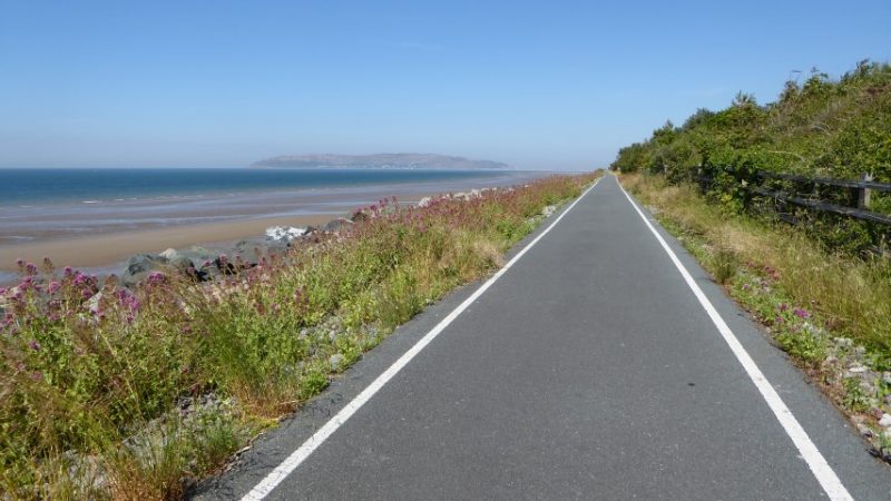
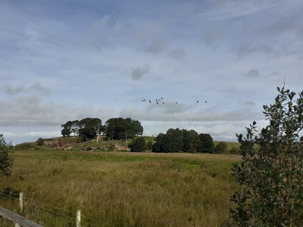
My journey to the Mariners’ Beacon is along a route that I know well. My trip is rather unique inasmuch as, 22 of the 23-mile from my home is on Sustrans paths. The route is also flat because it follows the course of former railway lines. NCR 5 takes me through the centre of Chester and across the border into Wales. At Sealand, I fork right and head north through the Deeside Industrial Park, which is built on the site of former steelworks land, where I worked in the 1970s. The route takes me past a paper mill, a Toyota engine factory and various food-manufacturing sites. The industrial park has been thoughtfully designed and equipped with good cycle paths. I pass beneath the A548 as it rises towards the Flintshire Bridge. Crossing back into England I follow the route along a wooden boardwalk, past Burton Point and the Dogs Head rock. On the boardwalk a large skein of Canada geese fly low over my head. They head west, over the marsh and the Dee estuary heading towards the Point of Ayr, mainland Wales’ most northerly tip. The sight, sound and close proximity of these birds present me with one of those magical moments that I can only record and treasure in my memory.

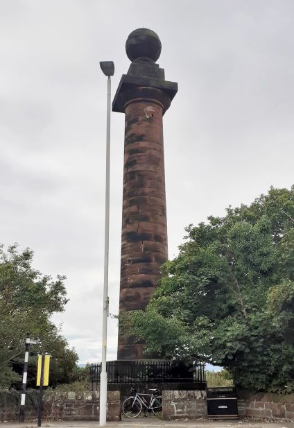
I use this pathway often; it’s a cycle friendly route to the former seaside village of Parkgate. Here I join the Wirral way, a path that takes me through Gayton, Heswall and a golf course. At Caldy, I leave the path and take to the roads. Caldy Hill is an upward climb through the million pound mansions of the wealthy. It’s not a difficult or long climb, and I soon find myself on the busy and aptly named, Column Road, where I soon find the Mariners’ Beacon just beyond the local Grammar School.  Here, carved into the base of the landmark, I find the answer to the checkpoint question… What date was the foundation Stone Laid?  

The Mariners’ Beacon stands above West Kirby near the northwest corner of the Wirral peninsular. It’s a 60-foot sandstone column with a ball on the top standing on Caldy Hill, 256 foot above sea level. The landmark’s name and purpose are self-explanatory. Looking up from sea level, the landmark still stands out against the Wirral skyline. A windmill once stood on this site, which became a favoured landmark for sailors navigating towards the mouth of the Mersey and Port of Liverpool.

In 1839 a powerful storm destroyed the mill, and the sailors lost their landmark. All that remains today is the millstone resting at the base of the beacon’s column.  

Following the mill’s destruction, the seafarers asked the trustees for Liverpool’s docks to reinstate a landmark, so that they could again have something on this site to act as an aid to navigation. Two years later the ruined mill was replaced with the sandstone column that we see today.
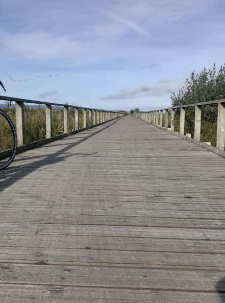
The Boardwalk near Burton Point

My great grandfather was in the Merchant Navy during the late 19th and early 20th centuries. The mill was destroyed before his time. I’m sure he would have viewed the Mariners’ Beacon as a welcoming landmark as he returned home to the Port of Liverpool, his wife and three children in Mandeville Street.

Instead of finding an alternative and more complex route home, I returned the way I had come, rewarding myself with that sausage butty at Net’s Coffee Shop.
Anglesey – Day Two – NCR5, Telford’s bridge, seaside resorts, caravan parks, a golf course, sand dunes and rumours of a ghost.

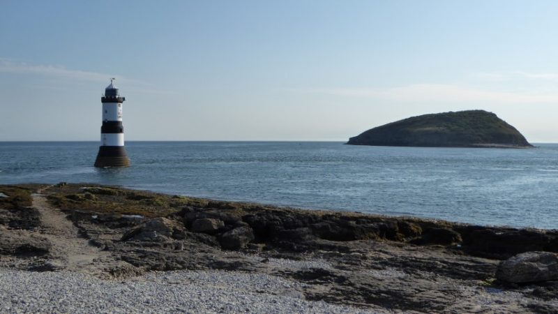
Penmon Point Lighthouse with Puffin Island . Anglesey’s most westerly point.

I’d packed up and was out of the campsite by 7:15 am. Another long, hot day was promised but before heading homeward, I visited the Penmon Point lighthouse; this is at the most westerly tip of Anglesey. I had hoped that it would be quite at that time of day but half a dozen camper vans had parked there overnight and several of them had managed to park as close to the shoreline as possible detracting and spoiling the natural beauty of the place.

A few people were around and the sounds that I heard were those of the waves lapping against the rocks and the tolling of the bell buoy ringing its sad lament out in the channel between the Puffin Island and the shore. Nearby, I also heard the calls of terns as they tried, in vain, to deter a dog walker from trespassing on their beach.

On the road back towards Beaumaris I had a scare as I hit a really nasty pothole whilst freewheeling downhill. This happened in a matter of seconds and I was just about able to regain control of my fully laden bike and prevent myself from hitting the tarmac. Had I hit the deck, it’s likely that the cost of an ambulance and my medical bill would have far exceeded the cost of the pothole repair.

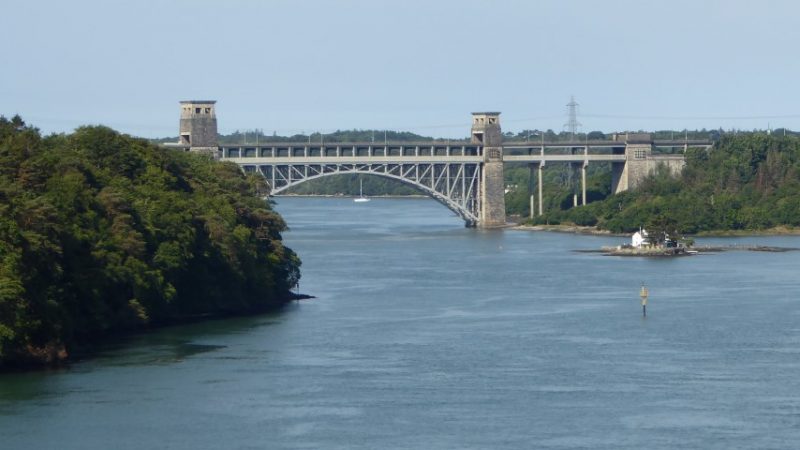
View of the Robert Stephenson’s Britannia Bridge from Thomas Telford’s Suspension Bridge.

I pass through Beaumaris once more with its splendid castle and soon cover the five miles to Menai Bridge. I cross the straits on Telford’s suspension bridge and entered the city of Bangor where unfortunately I got myself lost. Again, I find that I’m unable to understand the road signs due to my lack of understanding the Welsh language. I compensated for this by having a full English breakfast at the local Morrison’s supermarket with two pots of tea. It’s the best meal I’ve had on my journey and a third of the cost of the one that I hadn’t enjoy the previous evening.

From Bangor, national cycle route 5 (NCR5) contributes most of my route home and in fact passes within 100 yards of my door. At first NCR5 diced with the North Wales expressway and at one point it took me into the coastal hills giving me clear views back over the straits, to Penmon point, the lighthouse and Beaumaris castle. After a tea break at the Aber Falls tea room I passed through Penmaenmawr. NCR5 still kept the company of the expressway and here the road goes through a couple of tunnels, but the cycle path raises up and passes over the rocky outcrop for the first tunnel and then goes around the outside for the second tunnel.

This has to be one of the  most perfect coastal cycle paths. In my humble opinion. Near Penmaenmawr heading towards Llandudno with Great Orme on the horizon.

Beyond Llandudno junction I cut across the base of peninsular and head for Rhos on Sea. The next stage was perhaps one of the most enjoyable and easiest sections of all. For 16 miles I remained on the coastal path as it took me through Colwyn Bay, Rhyl and Prestatyn.  I was also fortunate to have the wind at my back. The cycling becomes easier despite the load that I carry I was clocking 12 to 14 miles per hour and only touching the brakes to slow down for pedestrians, other cyclist and dog walkers. I was still a long way from home but it’s almost a reward for the hard work, investment of energy, and sacrifice to the heat. This is a time that I will remember, and I’m happy and filled with the joy of cycling.

At Prestatyn, I pass through the local golf course, beyond that, I coast around the curves of the Presthaven Sands Beach Resort and after that; I follow a beautiful tarmacked path through the dunes at Talacre.  Along this section I am surrounded by the sound of grasshopper warblers among the scrub and bushes. This is a bird that I often hear during the spring and early summer months but have never seen. (A grasshopper warbler sounds like a fishing reel being drawn out.)

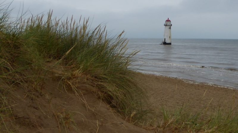
As I continue through the dunes I see the Point Of Ayr lighthouse. Both Lighthouse and Beach along with an Old English Sheep dog once featured in a 2011 TV advert by a famous paint manufacturer. The failure of the paints resilience now stands as a testimony to the winter storms. The lighthouse looks forlorn, lonely and unloved and it has a slight list towards the setting sun. Built in 1776 and decommissioned in 1884, it is reputed to be haunted by a former lighthouse keeper called, Raymond.

Point of Ayr lighthouse. Mainland Wales’s most northerly point.

I have a childhood memory of charging down these dunes. I also remember exploring derelict timber holiday chalets. Deserted for many years, they were slowly being reclaimed by the sand. On a nearby hillside and amongst the trees I also remember the sound of a bell ringing at Talacre Abbey which, at that time, belonged to a closed order of Benedictine nuns.

Point of Ayr was the site of one of the last mines in the North Wales coal field. Today, like many former industrial sites it has become a nature reserve.  As I follow the path through the evening dusk I see the silhouette of a man and a horse. As I get closer I discover that it is a sculpture representing a miner with a pit pony. The last pony retired in 1968 and the mine closed in 1996. Further on, there is a piece of pit winding gear, this has been modified and now stands as another monument to the past. Eventually, the cycle path leads me back to a road and I join the A548.

At 10 o’clock; I switch my cycle lights on. At Llannerch-y-Mor, I pass the silhouette of the Duke of Lancaster. This steam turbine ship has stood here for the last four decades. Its last role was as a Sealink car ferry shuttling across the Irish Sea. The road ahead of me is gloriously wide, flat, and quiet. The moon is up now and it is a full one in a clear night sky. The night was cool but not cold and although I was beginning to ache, I was still 20 miles from home. I felt like I was in a magical place as I headed towards Flint. I treasure and store each of these precious moments like childhood reminiscence. Beyond Flint, I countdown the towns as I press on through, Connah’s Quay, Shotton and Queensferry. At Drome corner, I join Sealand road, unlit, the road is dark but the full moon is all that I need as I cycle the remaining miles home.

I arrived home at one a.m. and it was to be another hour before I fell exhausted into bed. I’d covered 90 miles over 18 hours, a not so spectacular five miles an hour average. I slept well!

Wilfred Owen Story

My Subject is War and the Pity of War  –  Wilfred Owen

Detail from the stained glass window at Birkenhead Central Library. Designed by David Hillhouse.   

One story often leads to another. On my visit to the war memorial at Port Sunlight, please see previous posting, I was very much reminded of the Poet, Wilfred Owen whose words surround the base of that monument.

I first found out about Owen’s poetry when I was doing my English Literature GCE O level. What fascinated me most about his poetry were his references to Christianity. Indeed, one of the very few poems that I’ve ever been able to recite was his ‘At a Calvary near the Ancre’.  Before my GCSE exam, I knew that I would have to be able to remember at least one poem, this one was perhaps a little outside the mainstream; everybody else was choosing either ‘Anthem for Doomed Youth’ or ‘Dulce Et Decorum Est’.

‘At a Calvary near the Ancre’ identifies the hypocrisy within the church at that time alongside Owen’s own struggle to reconcile the Christian faith against the horrors of war. All this is 100 years ago now and thankfully the church has moved on, and, if nothing else, has learnt and continues to learn from its past mistakes.

At a Calvary near the Ancre

One ever hangs where shelled roads part.
In this war He too lost a limb,
But His disciples hide apart;
And now the Soldiers bear with Him.

Near Golgotha strolls many a priest,
And in their faces there is pride
That they were flesh-marked by the Beast
By whom the gentle Christ’s denied.

The scribes on all the people shove
And bawl allegiance to the state,
But they who love the greater love
Lay down their life; they do not hate.

n.b. The Ancre is a tributary  to the river Somme

The horrors of the war clearly challenged Owen’s Christian beliefs, but whilst he was critical of the stance that the church had taken both over the war and with its role in society, I’d prefer to believe that he himself  didn’t lose his faith. Indeed, in a 1917 letter to his mother, he wrote “Christ is literally in no-man’s-land. There, men often hear His voice”. Owen questions whether Christ’s voice is only heard in English and French. He then goes on to say that “Pure Christianity will not fit in with pure patriotism”.

The 4th November this year, will mark the centenary of Owen’s death. So now is a good time for me to pitch a proposal to a magazine for an article on his early life.  Born in Oswestry, Owen is mostly associated with Shropshire, however, for an important seven year period, his family lived in Birkenhead and the town has much to show for the Poet’s early life. It was whilst he was here at school that his love of poetry was born.


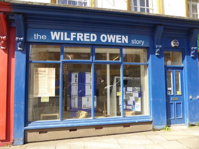
Wilfred Owen Exhibition – 34 Argyle Street

Last week I visited the Wilfred Owen Story at 34 Argyll Street, Birkenhead. The exhibition here has numerous displays which include copies of some of his letters and personal artefacts relating to his life and family. For anybody who is interested in Wilfred Owen or who may wish to discover him for the first time, then the exhibits here will give you a fascinating insight into his life.

His father was the Station Master at Woodside Central Station. The young Wilfred attended school at the Birkenhead Institute and the family went to the local parish church of Christ Church. Between 1900 and 1907 the Owen family lived in the Tranmere area of the town, moving house on two occasions. At the exhibition I picked up a leaflet giving a map for the Wilfred Owen trail, this passes each of the three houses where the Owen family lived, along with the church, the site of his school, and also Birkenhead’s central library.

The library is particularly worth a visit because it has an impressive stained glass window on its central staircase dedicated to Owen. On the landing area there are also further displays to commemorate Owen’s life.


More information on The Wilfred Owen Story can be found at http://www.wilfredowenstory.com/index.html

It is a sad irony that only in this last week, the UN has been discussing the use of chemical weapons in Douma, Syria,  ten miles north of Damascus. Owen’s famous poem, ‘Dulce Et Decorum Est’, graphically portrays the use of such a weapon. If he were with us today, I wonder what he would be thinking. One of the lessons that mankind learnt from Owen’s war was that this sort of weapon should never be used again. Despite it being 100 years on, it now seems that not all men learn from history’s lessons.

Roads less Travelled

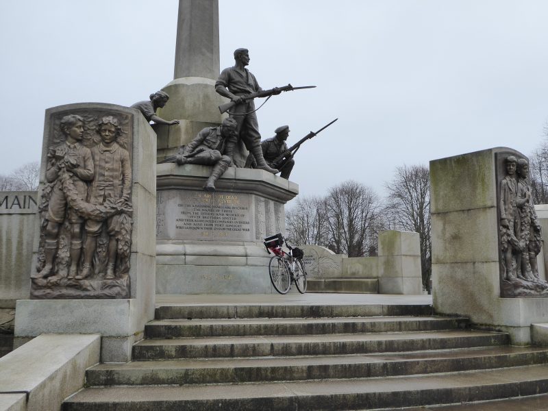
Port Sunlight Garden Village War Memorial

Cycling UK, runs a challenge based around a comprehensive list of 402 destinations. British Cycle Quest is a nationwide treasure hunt with the objective to visit as many locations as possible. To provide evidence that you have visited each site you need to answer a simple question about each one. The only real stipulation is that you must visit each place by bike. Start it today and you could take part in this for the rest of your life. The destinations listed, provide an endless reason to explore new roads. The garden village at Port Sunlight is one of the closest locations to my home, and its question can only be answered by a visit to the village’s magnificent war memorial.

Port Sunlight is only twelve miles away, but the A41, the road that provides my most direct route is busy and cycling along that stretch of road brings no pleasure at all. In this part of England, the best cycle routes are seldom provided by ‘A’ roads.

When I’m cycling, I prefer to have an objective in mind. Fortunately, the UK is full of destinations and even rides over moderate distances can still yield surprises. Britain has an abundance of roads, so there are often alternative routes to discover. These days I seldom find roads close to home that I’ve not ridden before, so when I do come across one it makes a welcome change.

Heavy cloud was forecast when I set off to find an alternative route to Port Sunlight. I have usually approached it from the west in the past, so approaching it from the side of the river Mersey would provide both a change of scenery and a challenge. Both Chester’s and Wirral’s local authorities provide alternative routes for cyclists and support them with excellent leaflets and maps. Alongside these I have the established routes provided by the Sustrans National and Regional Cycle Network. With these I was able to plan a route beforehand that ran north-east of the M53 and parallel to the Manchester Ship Canal and the Mersey. This included a stretch from the Boat Museum at Ellesmere Port, behind the Vauxhall car plant and through to Eastham Country Park, a four mile stretch of industrial road with no views of either the Mersey or the Manchester Ship Canal.

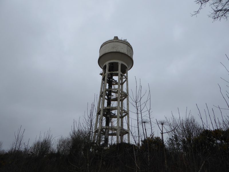
Water Tower on former Bowater paper mill site.

The North Road out of Ellesmere Port services the industrial areas north of the town. It’s quiet most of the day with the exception of shift change times. It’s a wide unattractive road and as I cycled along it I was reacquainted with the smells of oil and heavy industry that reminded me very much of the days when I worked at Shotton steelworks. This isn’t a road for cyclists or tourists, but on that day, it suited my purpose because it provided the most convenient route from A to B. When the M53 was constructed, in 1975, the North Road was sliced into two sections, but fortunately someone had the foresight to put a subway under the motorway that linked the two pieces of road making the original route still accessible to pedestrians and cyclists.  Despite it only being within 15 miles from my home, I’d never used this road before.

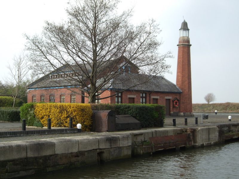
Whitby Lighthouse , Overpool, Ellesmere Port

Significant landmarks on my journey included the Whitby Lighthouse and the water tower that formerly belonged to the Bowater paper mill, this is a notable feature of the local skyline. After passing through the industrial landscape of Port Sunlight, I crossed the busy A41 and entered the garden village. For the east side of the Wirral, this remains a haven of peace and tranquillity, the roads are wider, quieter, and the atmosphere seems a world away from the industrial and overcrowded stressful Britain that many of us have become acquainted with. If only today’s planners and developers tried to emulate this more, I feel that we would be a lot happier as a nation. The interesting thing about Port Sunlight’s Garden Village is that it was built by one of Britain’s great industrialists.

William Hesketh Lever, considered the building and design of his village as more of a business model than a philanthropic gesture. He saw it as a way of sharing his company profits with his employees by providing decent, affordable housing with schools and amenities. His intention was to inspire loyalty and commitment from his work force. This was seen as revolutionary at the time and more than a hundred years on, it still looks good.

I made my note of the inscription on the war memorial and then headed back home.  Returning the same way helped me to appreciate the route from a different perspective. My journey  through north Cheshire and south-east Wirral included pastoral farmland, canal side tranquillity, derelict industrial sites, modern industrial estates and a country park with views across the estuary to Liverpool. And I have all this rural, industrial and social heritage, within 15 miles of home.

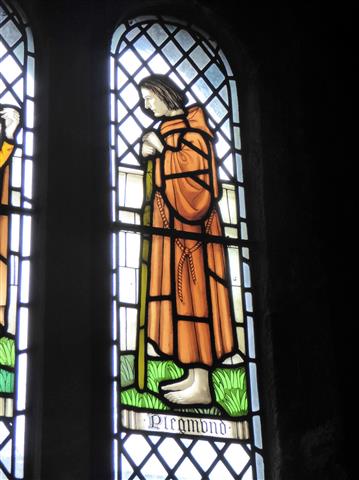
Plegmund

(The later part of the 9th Century – North Mercia)

‘There is a messenger looking for you Father!’

‘Saxon, Celt or Dane?’ the holy man asked cautiously, these were dangerous times and he knew that whatever the answer, it could have very different consequences.

‘Saxon, from Wessex,’ said the man.

‘English? ’ The Holy man grunted and smiled to himself, he knew he was safe. ‘What does Alfred want with me?’

Of course, there is no evidence that this conversation actually took place. But a thousand years ago we know that Alfred, King of Wessex came looking for a scholar who lived in the marsh land south of the River Mersey.

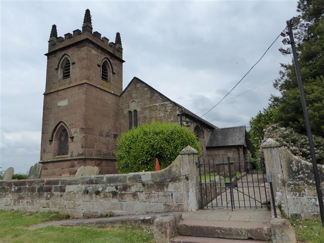
St Peter’s Church, Plemstall.

Four miles north-east of Chester stands the isolated church of Saint Peters, Plemstall, the holy place of Plegmund. The current church dates back to the 15th century before that, there was an earlier church dating back to the 12th century. But the history, the myths, and the legends that surround this place go back even further. One legend tells of a fisherman, caught in a storm, whose prayers for safety were answered  when he was washed ashore here at a place then known as the Isle of Chester. In return, he built a church and dedicated it to St Peter the fisherman. This may have been as early as the 5th century.

By the 9th century this place was the home of Plegmund, a Christian, a man of God, living in an ungodly world. Back then, Plemstall stood on the northern limits of Mercia. To the North  was Northumbria and in the hills to the West were the Celts.  The Danes held much of the land north of Watling Street. In 869 they had tied King Edmund to a tree and filled him with arrows.

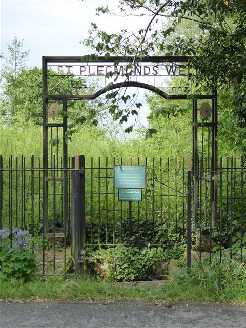
Today, Saint Peter’s Plemstall stands at the end of a narrow lane; its only company is a bungalow and a couple of nearby farms. 300 yards from the Church stands a well, protected by iron railings.  Today, it is known as St Plegmund’s well, but a thousand years ago it was a freshwater spring amongst the tidal marshes of what we know today as the River Mersey. Here, Plegmund baptised local children. But as well as being a Holy man, he was a scholar and one of the cleverer men of his age. One early description of him was as ‘an eremite’; even then people had a tendency to drop their Hs.

St Plegmund’s Well, Plemstall Lane, Mickle Trafford, Chester

At some point Plegmund was called away to serve both his King and the church. In 891 Alfred appointed him as the 19th Archbishop of Canterbury. During his time, Plegmund was to visit Rome on two occasions and after Alfred’s death in 899, he crowned Alfred’s son, Edward the Elder, King of England. Plegmund held the post of Archbishop until 914.

Today, Plemstall’s slightly elevated position isn’t obvious until you enter the graveyard to the east; here you can see that the land falls away towards the River Gowy. Beyond that, the landscape rises again toward Cheshire’s sandstone ridge; this comes to an abrupt end, a few miles away, with the sandstone escarpment of Helsby Hill.  In the 9th century, Helsby would have been a Viking settlement!

This is  a quiet, tranquil place and your imagination doesn’t have to work hard to visualise what it would have been like a thousand years ago when this land was either under threat or under the control of the Danes. In the years that followed, Chester fell to the Danes, only for them to be ousted by, Æthelflæd, Lady of the Mercians and Alfred’s daughter.

Today the church and the surrounding area are sensitively managed. Behind the church is a wild flower meadow. In the lane leading to the church new woodland has been planted. A visit in spring rewards the visitor with a variety of birdsong. Finches, tits and warblers predominate, and overhead you might hear the song of a high flying skylark. Across the fields can often be heard the repetitive call of a Yellowhammer. Beyond the church and alongside the river there is an owl box perched on a pole. I don’t know whether it is occupied, but I imagine that the wetlands alongside the river would provide an ideal territory for such a bird.

Whenever I visit Plemstall, I experience a feeling of contentment. There is something about the place that defies today’s world. The past is so evident here that you can almost touch it. Maybe Plegmund left something of himself here.

St Plegmund – South Cloister Window, Chester Cathedral.

A Cheshire View

To get  some perspective, one must first climb to a high place.

There are many routes to the top of Pale Heights. Earlier this year I approached it from Mouldsworth, passing Eddisbury Lodge and Nettleford Wood. At other times I have climbed it from Gresty’s Waste, Yeld Lane, The Delamere Forest Visitor’s Centre and Barns Bridge Gates. I think that the most testing route however is the one that takes the service road leading up from Delamere Station to the communication masts. This route makes little consideration for the hill’s contours and uses the most direct route to the top passing Old Pale Farm on its relentless climb.

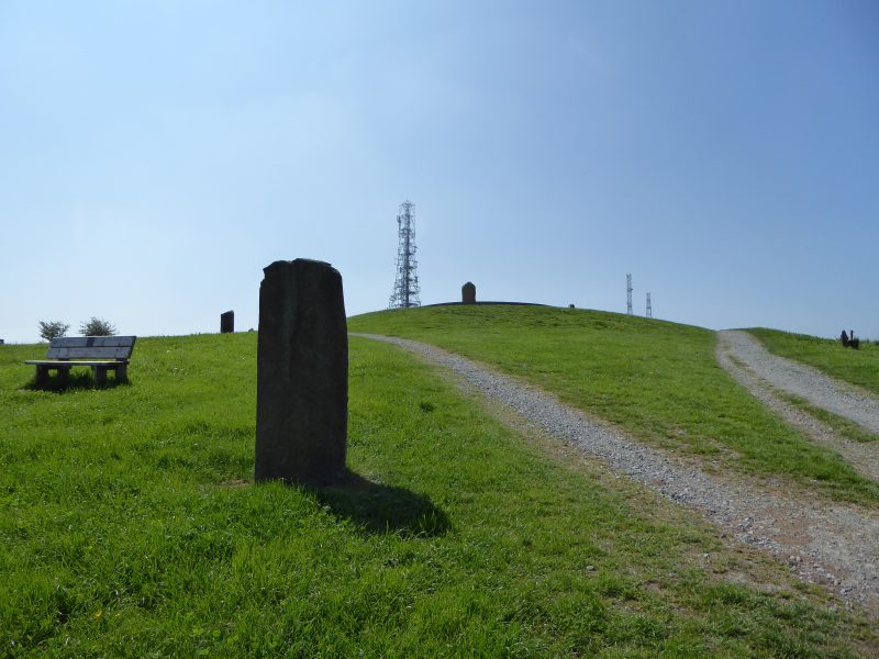
Close to Kelsall, this seemingly unremarkable hill can be identified by the three telecommunication masts that stand on its summit. At 577 feet, the hill looks over the Cheshire plain and provides spectacular views to the north, east and west. It’s central position in the county means that the hill rewards both walker and cyclist with probably the finest panoramic views that they will find of Cheshire.

I’m not a big fan of uphill cycling, but Pale Heights is a favourite that I consider worth the effort. I cycle up here at least once each year; it’s a climb that tests my stamina and fitness. Eighteen months ago I bought a new bike and the first thing I did, to put it to the test, was cycle up this hill.

Pale Heights is modest hill, particularly when compared with Moel Famau at 1,820 feet, the highest point in the Clwydian hills, and the most notable feature on the western skyline. To the north-east you can see Manchester Airport and over in a south-easterly direction is Jodrell Bank. In midsummer the sun can be seen setting into Liverpool Bay. This is one of the few places from which you can see both Liverpool and Manchester.

To the east there are views towards the Peak District, including Shining Tor on the Derbyshire border, whose 1,834 foot summit is the highest point in the county and three times higher than Pale Heights. Beyond can be seen Kinder Scout, Derbyshire’s highest point.

Much nearer, beyond the farm and situated on the hill’s south-east shoulder, stands Eddisbury Hill fort, an Iron Age earthwork that gives the local parliamentary constituency its name. That area is also called Old Pale. The term Pale is used to describe an area of enclosure land; possibly in this case it was used to protect deer or livestock from poaching and theft.

Delamere forest, which surrounds Pale Heights today, represents the last remnants of the ancient hunting forest of Mara once belonging to Edward, The Black Prince. Amongst the prince’s titles was, Earl of Chester. Edward was son to Edward III and father to Richard II. He was a Prince however destined never to become a King.

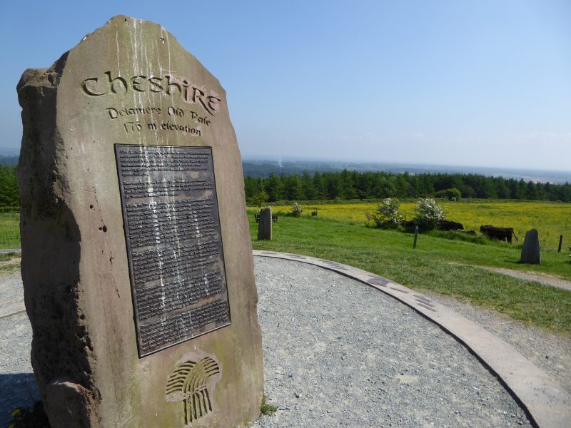
Today, Pale Heights is marked by a modern-day stone circle, each stone originating and representing one of the seven counties that can be seen from this point. The central stone represents Cheshire and is made from the local Sandstone. This stone is encircled by a set of small metal plaques identifying the many landmarks that can be seen from this vantage point.

From Chester, Pale Heights is a great bike ride and can be cycled in a little over an hour each way. It’s a good place to go with other people but it’s also a great setting if you want to be alone. As in biblical times, high places can still be good locations to talk with God. Regardless of your faith however, Pale Heights is always a good place to fill your lungs with fresh air and get some perspective.

A Name in Stone

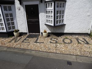
Front of Nelson cottage in Parkgate, Cheshire.

Deserted by the sea that once provided its livelihood, Parkgate stands on the Dee estuary. The village is a fascinating place to visit; many of its buildings are unique and some have stories to tell. Nelson Cottage in Station Road has a story, and the property is easily identified by its cobbled frontage.

Early in the 19th century this cottage was the holiday retreat of the portrait painter Albin Roberts Burt. Albin had a good reputation and specialised in miniature portraits. Half a dozen of his pictures hang in Britain’s National Portrait Gallery. In November 2016 a London auction sold Albin’s two inch sketch of Lord Nelson for an estimated £12,000.

Albin moved around quite a bit in his lifetime, but in 1822 he was living in Chester. In early December that year he decided to visit Liverpool, and took his nine year old son along with him.

Historic facts can be difficult to verify, but reports suggest that the journey was done by boat using the Shropshire Union Canal from Chester to Nether Pool: now part of Ellesmere Port. On route he would have passed St Lawrence’s church at Stoak which may have been undergoing restoration at that time. The church dates back to the 14th Century, but was restored in 1827. At Nether Pool, father and son transferred to a ferry to cross the Mersey basin to Liverpool.

Having finished their day’s  business they began the return journey home. That evening, however, tragedy struck. The Prince Regent steam ferry ran out of fuel and the boat was at the mercy of the strong winds. A hurricane struck the Liverpool Bay area, and nine people fell overboard from the ferry that night including Albin’s son, Nelson.

Saddened following the loss of his son, Albin walked along Parkgate beach and collected black stones. On returning to Station Road he used the stones to spell out his son’s name in front of the cottage. The stones remained loosely in place until the 1920’s when they were set in cement.

View of St Lawrence’s church Stoak from Shropshire Union Canal tow path.

I often cycle along the canal towpath between Chester and Ellesmere Port, and think about the young boy and his father making that last fateful journey. At Stoak, I can see St Lawrence’s church three hundred metres beyond the canal. I have family resting in the churchyard. I’m aware that a small boy lost in a storm almost two hundred years ago also lies there. I’ve known this for many years but until recently didn’t know his name.

Whilst researching my article on Parkgate for Best of British magazine I discovered this grave was the final resting place of young Nelson.

Grave of Nelson Burt, St Lawrence’s churchyard, Stoak, Near Ellesmere Port, Cheshire.

On a summer evening I visited St Lawrence’s churchyard. I could look up my relatives and see if I could also find Nelson’s grave. It wasn’t hard to find; it was the one closest to the south of the church tower. Nelson may have the oldest grave in that churchyard and its position means that he probably gets the maximum amount of sunlight. The headstone inscription explains the circumstances of his death. An interesting thing about this grave is that it has both a head and a footstone.

On the 5th December 1822 a small boy died under tragic circumstances. Maybe he could have become a  famous painter like his father, or a great leader of men like his namesake. We will never know, but today we still know Nelson Burt’s name because it has been set in stone.

Miniature portrait of Nelson Burt aged 8, painted by his father Albin Roberts Burt.

Painting reproduced with the kind permission of Claudia Hill @ Ellison Fine Art.     http://www.ellisonfineart.com/