Category Archives: British Cycle Quest

The Mariners’ Beacon (BCQ 332)

The Mariners’ Beacon, Grange, Wirral, Merseyside.

Burton Point

I’ve not added to my list of British Cycle Quest checkpoints for some time. On BCQ rankings, I’m categorised as having “just started”. This is because I’ve yet to submit ten checkpoint answers. I’d probably be closing in on three figures by now, if I’d started twenty years ago.

My first objective is to cycle to the checkpoints within the pre 1974 boundaries of Cheshire. That’s Cheshire as it existed when I was born, and before Merseyside and Greater Manchester took chunks out of it.

There are eleven checkpoints within my definition of Cheshire. All are within a day’s ride from home. The furthest is at Style Mill near Wilmslow, which at 37 miles is a decent run considering I have to get back home as well. Before the Mariners’ Beacon checkpoint, I’d already visited five locations in Cheshire and a couple in North Wales, so my total stood at seven.

The Mariners’ Beacon

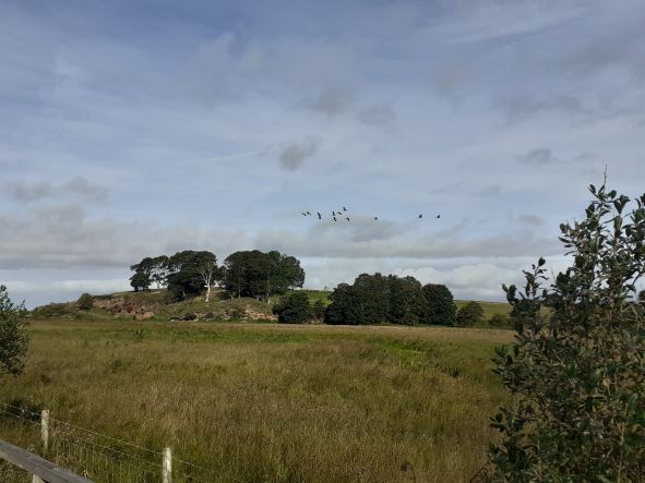
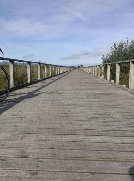
My journey to the Mariners’ Beacon is along a route that I know well. My trip is rather unique inasmuch as, 22 of the 23-mile from my home is on Sustrans paths. The route is also flat because it follows the course of former railway lines. NCR 5 takes me through the centre of Chester and across the border into Wales. At Sealand, I fork right and head north through the Deeside Industrial Park, which is built on the site of former steelworks land, where I worked in the 1970s. The route takes me past a paper mill, a Toyota engine factory and various food-manufacturing sites. The industrial park has been thoughtfully designed and equipped with good cycle paths. I pass beneath the A548 as it rises towards the Flintshire Bridge. Crossing back into England I follow the route along a wooden boardwalk, past Burton Point and the Dogs Head rock. On the boardwalk a large skein of Canada geese fly low over my head. They head west, over the marsh and the Dee estuary heading towards the Point of Ayr, mainland Wales’ most northerly tip. The sight, sound and close proximity of these birds present me with one of those magical moments that I can only record and treasure in my memory.

I use this pathway often; it’s a cycle friendly route to the former seaside village of Parkgate. Here I join the Wirral way, a path that takes me through Gayton, Heswall and a golf course. At Caldy, I leave the path and take to the roads. Caldy Hill is an upward climb through the million pound mansions of the wealthy. It’s not a difficult or long climb, and I soon find myself on the busy and aptly named, Column Road, where I soon find the Mariners’ Beacon just beyond the local Grammar School.  Here, carved into the base of the landmark, I find the answer to the checkpoint question… What date was the foundation Stone Laid?  

The Mariners’ Beacon stands above West Kirby near the northwest corner of the Wirral peninsular. It’s a 60-foot sandstone column with a ball on the top standing on Caldy Hill, 256 foot above sea level. The landmark’s name and purpose are self-explanatory. Looking up from sea level, the landmark still stands out against the Wirral skyline. A windmill once stood on this site, which became a favoured landmark for sailors navigating towards the mouth of the Mersey and Port of Liverpool.

In 1839 a powerful storm destroyed the mill, and the sailors lost their landmark. All that remains today is the millstone resting at the base of the beacon’s column.  

Following the mill’s destruction, the seafarers asked the trustees for Liverpool’s docks to reinstate a landmark, so that they could again have something on this site to act as an aid to navigation. Two years later the ruined mill was replaced with the sandstone column that we see today.

The Boardwalk near Burton Point

My great grandfather was in the Merchant Navy during the late 19th and early 20th centuries. The mill was destroyed before his time. I’m sure he would have viewed the Mariners’ Beacon as a welcoming landmark as he returned home to the Port of Liverpool, his wife and three children in Mandeville Street.

Instead of finding an alternative and more complex route home, I returned the way I had come, rewarding myself with that sausage butty at Net’s Coffee Shop.

Chirk, Llangollen and Beyond

BCQ 502 Carrog and BCQ 505 Llangollen

I’ve cycled along many a canal towpath, and they have provided me with traffic free routes both into and out of numerous cities and historic towns. Canals are easier to track on a map and unlike rivers which tend to aimlessly meander until they reach the sea, canals were built for a purpose, and they can take you into and away from places often without you having to endure the hassle of other traffic.

National Cycle Route Number 85

Two British Cycle Quest (BCQ) locations in North East Wales are in the Vale of Llangollen and are also only ten miles apart.  To get to them, I let Britain’s industrial heritage help me. Firstly by letting the ‘train take the strain’ I travelled from Chester to Chirk. Then I cycled along the Llangollen canal towpath that took me into the heart of the Vale of Llangollen.

Britain has 2,200 miles of man-made canals and this stretch of the Llangollen canal stakes a claim at being perhaps the most picturesque of them all. Between the Welsh border town of Chirk, where the River Ceiriog marks the boundary between England and Wales, and Llangollen; the canal includes some terrific feats of 19th century engineering. These include two aqueducts and two notable tunnels.  Together these are so important, that the 11 mile stretch from the Chirk aqueduct to the Horseshoe Falls beyond Llangollen make up one of the UK’s, UNESCO World Heritage sites.

Chirk Aqueduct taken from above the tunnel entrance.

Whilst crossing the Chirk and the Pontcysyllte aqueducts with their spectacular views is a delightful experience, I have to say that the tunnels could be a little daunting for some, unless you have a torch to light your way, which I didn’t. Both tunnels have a decent path and a sturdy rail that runs between you and the canal. The Chirk tunnel is the longer of the two at 420 metres in length. This can be quite dark and whilst walking my bike through that tunnel I could hear unseen water running down some parts of the walls, however none of this fell on me. The second tunnel known as the Whitehouse tunnel is 175 meters long and fortunately, there was no sound of any running water.

Beyond and between the tunnels, a lot of the canal passes through deciduous woodland and the sunlight pours through the fresh green leaves creating dappled sunlit patterns on the path and the canal before me. I can smell also the subtle scent of garlic and there are sizeable swathes of ramsons or wild garlic which were currently in bloom and have colonised much of the woodland floor alongside the canal.

Ramsons, more popularly known as Wild Garlic

It’s a ten mile stretch of towpath from Chirk to Llangollen and I can take it easy. A steady eight miles per hour is sufficient to enjoy the scenery and beauty of this wonderful countryside. There is a lot to enjoy and I stop to watch a mother Mandarin duck with her seven chicks. A mile or so further on a bold grey heron seems prepared to stand its ground as I approach. I fear that the heron would be a danger to the young mandarin ducks which are quite a rare species in the UK.

I follow the canal to Llangollen, and here there is a short length of my journey where the canal, the road, the railway and the River Dee all run alongside each other.  After the Chainbridge hotel I continue along the towpath until I come to the Horseshoe Falls. This is the end of the canal, or perhaps more accurately the beginning of it, because it is here that there is a sluice gate that takes water from the river to feed the canal.

From the Horseshoe Falls I then followed the quiet road north of the Dee heading west to the village of Carrog where I am in search of the name of the local Inn so that I can answer the first of my BCQ questions. Along this road I was able to appreciate the difference between cycling alongside a canal compared with cycling alongside the river. Although some stretches of this road run alongside the River Dee, within a relatively short length of road I am high up and contemplating the valley and the river from a much more elevated position. The downside of cycling for spectacular views is that you have to work for them.

It’s May, and the trees have a beautiful fresh green about them and much of the hillsides are still covered in blue bells. In the woods above the village of Carrog I hear the distinctive yaffle call of a Green Woodpecker, a bird that I regularly hear but for which a clear sighting has eluded me for some years now.

At Carrog, I note the name of the Inn, take my photos and then turn around to retrace my route. This time it seems easier, the uphill parts are less steep and there seems to be more downhill coasting than uphill struggling. At Llangollen I head north for my second BCQ question and search out Eliseg’s pillar which I find just beyond Valle Crucis Abbey on the road heading up towards the Horseshoe Pass.

Pontcysyllte Aqueduct looking west.

From there it’s a nice downhill freewheel until I meet up with the Llangollen canal again that will return me to Chirk. Ten miles on and I leave the towpath just before I enter the longer of the Chirk tunnels to discover that it comes out right by the station.

It was a good days cycling with both the canal towpath and the hills around Carrog providing me with some spectacular views. I also answered two more questions for British Cycle Quest.

Roads less Travelled

Port Sunlight Garden Village War Memorial

Cycling UK, runs a challenge based around a comprehensive list of 402 destinations. British Cycle Quest is a nationwide treasure hunt with the objective to visit as many locations as possible. To provide evidence that you have visited each site you need to answer a simple question about each one. The only real stipulation is that you must visit each place by bike. Start it today and you could take part in this for the rest of your life. The destinations listed, provide an endless reason to explore new roads. The garden village at Port Sunlight is one of the closest locations to my home, and its question can only be answered by a visit to the village’s magnificent war memorial.

Port Sunlight is only twelve miles away, but the A41, the road that provides my most direct route is busy and cycling along that stretch of road brings no pleasure at all. In this part of England, the best cycle routes are seldom provided by ‘A’ roads.

When I’m cycling, I prefer to have an objective in mind. Fortunately, the UK is full of destinations and even rides over moderate distances can still yield surprises. Britain has an abundance of roads, so there are often alternative routes to discover. These days I seldom find roads close to home that I’ve not ridden before, so when I do come across one it makes a welcome change.

Heavy cloud was forecast when I set off to find an alternative route to Port Sunlight. I have usually approached it from the west in the past, so approaching it from the side of the river Mersey would provide both a change of scenery and a challenge. Both Chester’s and Wirral’s local authorities provide alternative routes for cyclists and support them with excellent leaflets and maps. Alongside these I have the established routes provided by the Sustrans National and Regional Cycle Network. With these I was able to plan a route beforehand that ran north-east of the M53 and parallel to the Manchester Ship Canal and the Mersey. This included a stretch from the Boat Museum at Ellesmere Port, behind the Vauxhall car plant and through to Eastham Country Park, a four mile stretch of industrial road with no views of either the Mersey or the Manchester Ship Canal.

Water Tower on former Bowater paper mill site.

The North Road out of Ellesmere Port services the industrial areas north of the town. It’s quiet most of the day with the exception of shift change times. It’s a wide unattractive road and as I cycled along it I was reacquainted with the smells of oil and heavy industry that reminded me very much of the days when I worked at Shotton steelworks. This isn’t a road for cyclists or tourists, but on that day, it suited my purpose because it provided the most convenient route from A to B. When the M53 was constructed, in 1975, the North Road was sliced into two sections, but fortunately someone had the foresight to put a subway under the motorway that linked the two pieces of road making the original route still accessible to pedestrians and cyclists.  Despite it only being within 15 miles from my home, I’d never used this road before.

Whitby Lighthouse , Overpool, Ellesmere Port

Significant landmarks on my journey included the Whitby Lighthouse and the water tower that formerly belonged to the Bowater paper mill, this is a notable feature of the local skyline. After passing through the industrial landscape of Port Sunlight, I crossed the busy A41 and entered the garden village. For the east side of the Wirral, this remains a haven of peace and tranquillity, the roads are wider, quieter, and the atmosphere seems a world away from the industrial and overcrowded stressful Britain that many of us have become acquainted with. If only today’s planners and developers tried to emulate this more, I feel that we would be a lot happier as a nation. The interesting thing about Port Sunlight’s Garden Village is that it was built by one of Britain’s great industrialists.

William Hesketh Lever, considered the building and design of his village as more of a business model than a philanthropic gesture. He saw it as a way of sharing his company profits with his employees by providing decent, affordable housing with schools and amenities. His intention was to inspire loyalty and commitment from his work force. This was seen as revolutionary at the time and more than a hundred years on, it still looks good.

I made my note of the inscription on the war memorial and then headed back home.  Returning the same way helped me to appreciate the route from a different perspective. My journey  through north Cheshire and south-east Wirral included pastoral farmland, canal side tranquillity, derelict industrial sites, modern industrial estates and a country park with views across the estuary to Liverpool. And I have all this rural, industrial and social heritage, within 15 miles of home.